Fact Check: The Truth Behind “Seafloor Pressure” and Seismic Alerts Off the Oregon Coast 🌎📡
The Pacific Northwest has recently become the center of a viral storm. Posts circulating online suggest that catastrophic underwater events are unfolding near the Cascadia Subduction Zone, with some claiming the seafloor is actively “exploding.” However, a look at recent geological data reveals a more complex—but ultimately routine—scientific reality.

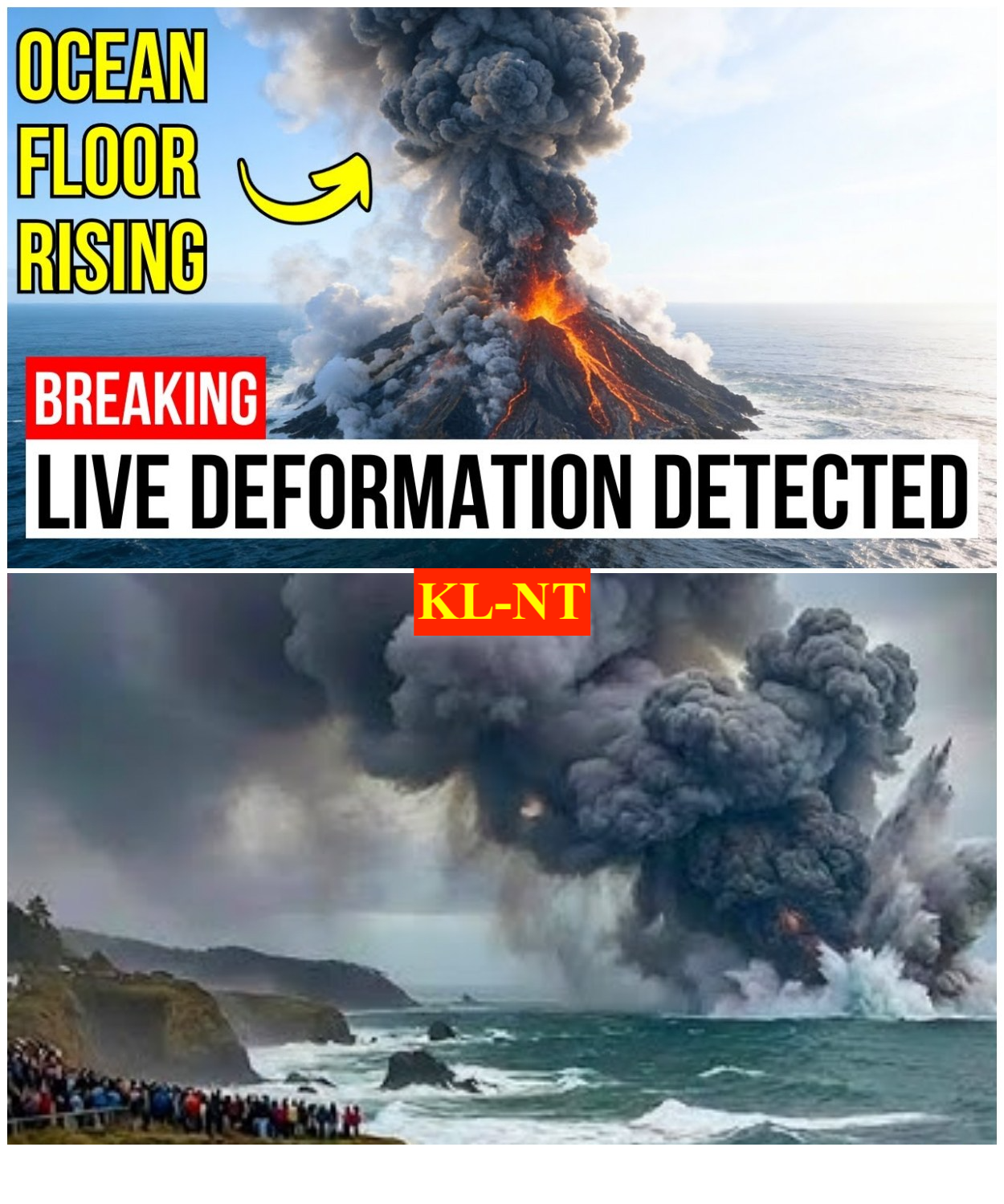
Understanding Axial Seamount: The Predicted Eruption
The core of the recent concern likely stems from Axial Seamount, an active underwater volcano located about 300 miles off the Oregon coast. Scientists from Oregon State University and the University of Washington have been tracking this site for years.
Currently, researchers are predicting an eruption at Axial Seamount sometime in 2026.
-
Seafloor Inflation: Monitoring instruments have detected significant “swelling” of the seafloor, a predictable sign that magma is moving beneath the surface.
-
Seismic Activity: While tiny “earthquake swarms” are common at this site, they are generally magnitude 2.0 or lower—hardly “explosive” to those on land.
-
The “Explosion” Myth: Experts emphasize that an eruption at this depth (nearly a mile underwater) would be “non-explosive.” Magma would likely ooze out as lava flows, creating new seafloor without posing a tsunami risk or impacting the mainland.

The Cascadia Subduction Zone vs. Fracture Zones 🌎
In January and February of 2026, the region did experience a series of moderate earthquakes, including a 6.1 magnitude event in mid-January and a 6.0 magnitude event on February 14.
-
The Epicenter: These quakes originated in the Blanco Fracture Zone, a series of cracks in the Earth’s crust disconnected from the more dangerous Cascadia Subduction Zone.
-
Routine Movement: Geologists note that one to two earthquakes of magnitude 5.0 or greater are expected in this area every year. These are “strike-slip” events where plates slide past one another, rather than the “megathrust” movement associated with the much-feared “Big One.”

Why Monitoring Systems “Flash Red” 📊🕵️♂️
The dramatic claims of monitoring systems “flashing red” often refer to real-time data from the Ocean Observatories Initiative (OOI). This underwater network of fiber-optic cables and sensors is designed to catch even the slightest shift in pressure.
-
Scientific Transparency: This data is public, meaning anyone can see spikes in pressure or seismic activity. However, without professional context, a routine spike in underwater hydrothermal vent activity can be misinterpreted by the public as a sign of imminent disaster.
-
Context is Key: Research into “Pythia’s Oasis”—a unique underwater spring off the Oregon coast—has shown that warm liquid gushing from the seafloor is a natural process that actually helps regulate pressure on the faults.

The Verdict: No Catastrophe Imminent ⚖️🔎
Geological agencies, including the USGS and the Pacific Northwest Seismic Network, have not issued any warnings for catastrophic events. While the Pacific Northwest remains a high-seismic-activity zone, current seafloor inflation and tremors are within the “expected range of behavior.”
“We are watching the data daily,” says one researcher. “But there is a significant difference between a volcano inflating for a future eruption and the seafloor ‘exploding’ in a catastrophic way.”